 The New York State Department of Environmental Conservation (DEC) is seeking public input on the Draft Recreation Management Plan for recreational access within the Speculator Tree Farm, Perkins Clearing, and Burnham Mountain Tracts in the Adirondack Park in Hamilton County, New York.
The tracts already include 36 miles of snowmobile trails and roads, several trailheads and parking areas – including Route 30, old Route 8 and “military roads” built at the time of the War of 1812.
These provide access to 17 primitive campsites and 14 mountains including Pillsbury Mountain (and its fire tower), along with numerous lakes and ponds and trout streams (including Spruce Lake).
The Northville-Placid and North Country National Scenic Trails run through the tract, as does the Miami, Jessup, Kunjamuk and Sacandaga Rivers (which includes Jessup Falls). A mountain biking trail network connects to Oak Mountain Ski Center.
 The easement properties encompass several tracts totaling 38,233 acres in the towns of Lake Pleasant, Wells, and Arietta, and the village of Speculator, much of it under timber production.
The properties share boundaries with two large Forest Preserve wilderness tracts – Siamese Ponds Wilderness and West Canada Lakes Wilderness – and the Jessup River Wild Forest.
Several other DEC facilities are located nearby, including Moffit Beach State Campground in Lake Pleasant, just off Route 8 on Sacandaga Lake.
Lewey Lake and the Indian Lake Islands State Campgrounds are about 12 miles north of Speculator; 11 miles south of the Village Speculator is the Sacandaga State Campground on Route 30.
The topography within the easements varies from flat, low-lying areas, to rolling hills and relatively small mountains. Of the nearly 300 named summits of Hamilton County, 14 are partially or wholly within the Perkins Clearing and Speculator Tree Farm Tracts.
While the highest elevation includes a portion of Dug Mountain exceeding 3,000 feet (the summit itself is on adjacent private land), most other mountain summits are between 2,000 and 2,500 feet.
Other points of significant elevation include parts of Cross (2,725 feet) and East (2,720 feet) Mountains. The lowest recorded elevation occurs at 1,385 feet at the location of the USGS benchmark near Auger Flats on the Sacandaga River.
History
There are no listed areas of archaeological sensitivity on these easements, however there are several areas of potential archaeological sensitivity, which DEC says the newest recreation plans don’t interfere with.
What is now called Jessup River Road and Old Military Road was part of the “Albany Road,” constructed across these tracts by the state in 1812 and which facilitated the transportation of supplies and troops during the War of 1812.
From Lake Pleasant, this route followed an old road to Perkins Clearing and Sled Harbor, continuing through the pass north of Pillsbury Mountain.
After the war, Philip Rhinelander, Jr. arrived at Lake Pleasant in 1815 and built a 300-acre estate on the sloping hillsides overlooking Elm Lake. Rhinelander had many servants and slaves to assist with tending to his farm.
It’s believed his young wife Mary was held prisoner in the residence. She became ill in 1818 and died shortly thereafter under suspect circumstances. Rhinelander left the estate in the 1820s.
 In 1887, the State Commissioner of Fisheries built a fish hatchery on the formerly named Mill Creek, known today as Hatchery Brook. The hatchery was dedicated to restocking nearby lakes and streams with trout and other fish native to the area.
1898, 1899, 1902 – International Paper obtained the Property began acquiring the property in 1898-1902. (In 1980 a Constitutional Amendment allowed the exchange of International Paper and Forest Preserve lands around Perkins Clearing.)
Lumbermen floated spruce and balsam pulpwood down the Jessup River into Indian Lake and on to the Hudson River to the Town of Corinth, home of the International Paper Mill.
In the mid 1940’s, during World War II, several flood dams were built on the Jessup River and its tributaries. The last of the river drives occurred in 1947.
In 1933 a Constitutional Amendment allowed the construction of Route 30 between Indian Lake and Speculator. The road was completed and paved in 1955 from near Northville to Long Lake.
On the morning of July 15, 1995, hurricane force winds caused severe damage and blowdown in the Northeastern U.S. This series of microbursts, or what became known as the “Ontario-Adirondacks Derecho,” affected parts of Perkins Clearing and Speculator Tree Farm Tracts.
Recreation Plans
On December 29, 2005, International Paper Company conveyed to the State of New York a working forest conservation easement over their Speculator Tree Farm, Perkins Clearing, and Burnham Mountain Tracts.
This conveyance was part of a larger land conservation agreement — the largest ever undertaken in the history of the State of New York — involving over 275,000 acres across 21 separate tracts in nine counties and 34 towns.
IP subsequently sold the lands encumbered by the conservation easement in 2005 and 2007 to subsidiaries of the Lyme Forest Fund Limited Partnership (Lyme Timber) of Hanover, New Hampshire.
In 2004, DEC completed an Interim Recreation Management Plan which established the current recreation opportunities. That plan was approved in anticipation of the this final Recreation Management Plan being developed and approved.
“DEC’s goal is to protect the natural resources, provide outdoor recreational opportunities for residents and visitors, and ensure these lands are an asset to the communities and a benefit to local economies,” said Regional Director Joe Zalewski. “These conservation easements preserve open space, protect against development, require sustainable forest management practices, and safeguard sensitive areas and ecological resources.”
 DEC proposes the following phased approach actions in the draft RMP:
Snowmobiling routes – Speculator Tree Farm East Mountain Loop Trail – 3.8 miles and the Fly Creek Road to Pine Mountain Trail – approximately 2.5 miles of trail, partly ungroomed;
Motor vehicle routes – Open one mile of new roads and build associated parking areas on High Bank Road to a scenic overlook and Jessup Falls Road to a short falls and fishing spot. Class 1 and Class 2 e-bikes are considered motor vehicles for the purposes of this RMP and are permitted on roads open to public motor vehicles;
Hiking routes – Improvements to the Pine Mountain Trail, Jessup Falls Trail, High Bank Overlook and the North Country National Scenic Trail;
Primitive camping – three campsites upgraded to accessible standards, three new campsites, and one new accessible lean-to;
Mountain biking routes – Trail network development in partnership with the Oak Mountain Ski Center property and local community;
Paddling – Improvement of existing car-top boat launches; and
Access for people with disabilities – a new lean-to and potential trail development, day use site, car-top boat launch, and additional campsite.
The proposed recreation management plan can be found here.
DEC will accept emailed and written comments until Sept. 16, 2025.
The public may also provide comments at an in-person meeting at the Lake Pleasant Central School Auditorium, 120 Elm Lake Road, Speculator, on Thursday, Aug. 28 from 6 pm until 8 pm.
DEC will begin the meeting with a brief review of the draft plan before opening the floor to members of the public to provide spoken comments for the record. Registration for this meeting is not required.
In addition to the public meeting, DEC is accepting written comments on the draft RMP until Sept. 16.
Comments can be submitted to R5.UMP@dec.ny.gov or mailed to Allison Buckley, Natural Resource Planner, PO Box 1316, Northville, NY 12134.
Read more about the Adirondacks.
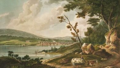
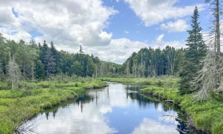
Illustrations from above, provided by DEC: one of the easements’ rivers near Speculator; map showing location of the tracts; a paddler on one of the easement’s rivers; road and trail map of the easements.
Source link