 Where the Hoosic and Mohawk rivers meet the Hudson River was a major Indigenous crossroads. Three major native pathways came together there: 1) The Hoosic River offered the main route east to New England, over the Berkshires and into Massachusetts. 2) The Mohawk River guided the way west. 3) The east side of the Hudson Valley provided a pathway north to Lake Champlain and Canada.
These well-worn trails, on which colonists later built their roads, linked the waterways used by Indigenous hunters, traders, and families moving between settlements. Stone, minerals, and other natural material from as far west as Michigan have been found in this region, revealing a broad network of trade among Native people, long before Europeans arrived.
Two other important trails intersected further north on the Hudson River: one where the Fish Kill and the Batten Kill meet the upper Hudson at Schuylerville and the other at Fort Edward, where the “Great Carrying Place” headed north to Lake Champlain.
A major Native gathering place developed along the Hudson, downstream from Baker’s Falls (later called Sandy Hill, and then Hudson Falls). Travelers coming from the Hudson headwaters could meet up with others coming from Canada, New England, or the lower Hudson Valley. Traders mingled, bartered, and shared news from faraway places.
 The four neighboring tribes — the Mohican, Mohawk, the Soboki Abenaki, and the Delaware (Lenape) — lived a life deeply connected to the seasonal migrations of birds, mammals, and fish that sustained them through long, cold northern winters, but they were also rooted in the places where food and medicinal plants grew.
The areas they once called home are marked by place names throughout the Hudson-Champlain corridor: Schaghticoke, Hoosac, Horicon, and Escudahki (Schodack) were Mohican and Mohican-Abenaki town sites. Saratoga and Schaunactoda (Schenectady) were Mohawk settlements. Many streams in the region still carry variations of their Indigenous names.
After the 1777 Battles of Saratoga, the places fortified during the earlier colonial wars – including Stillwater, Saratoga (Schuylerville), Fort Edward, Fort Ann, and Whitehall — became communities serving the needs of a growing population.
European Expansion
The rapids at the junction of the Mohawk and Hudson rivers near Waterford prevented boats from proceeding north unimpeded. Traveling from Albany to Lake Champlain required sailing batteaus as far as the rapids near Lansingburgh than dragging, kedging and polling your way north.
These shallow areas acted as a major barrier for cargo carriers. Batteaus traveling from Albany were forced to stop and unload their cargoes, which then had to be moved by oxen, horse or mule-drawn wagons over the long portage to the still water above Saratoga Falls.
During the French and Indian War (1754-1863) Colonel John Bradstreet, who led the Bateau and Transport Service, had sought but failed to remove Hudson River riffs and shoals to facilitate transportation, especially near Waterford.
 To the north, rapids interrupted navigation at Schuylerville and Fort Miller, Crocker’s Reef, and Baker’s Falls (Hudson Falls), where the river drops 80 feet over the course of a mile.
Indigenous people paddling the river carried their canoes around the riffles and falls on paths called portages by the French or carries by the British. Fort Miller was known as the “Little Carrying Place” because it was used to overcome the falls there.
Many travelers chose to take the more direct route to Lake Champlain, approximately 22 miles over land from Fort Edward to Wood Creek, a tributary of Lake Champlain at Fort Ann. This became known as the “Great Carrying Place.”
The Champlain Canal later followed the route of this portage, creating a navigable connection between river and Lake Champlain.
Building the Champlain Canal
Translating the vision of a canal between the Hudson River and Lake Champlain into a navigable waterway required a great deal of engineering expertise. Before anyone could dig a ditch or build locks and viaducts, surveyors had to determine the most level route between Whitehall and Fort Edward.
This section crosses the height of land that separates the Lake Champlain watershed from that of the Hudson.
The canal required a ditch with an adjacent roadway for the mules to tow the boats. A series of locks accommodated the 40-foot rise from Whitehall to the summit in Kingsbury and the 100-foot drop from the summit to Fort Edward, where the canal joined the Hudson at the mouth of the Moses Kill.
Work began on the Champlain Canal in 1817, south of Whitehall. By the following year, 12 miles of canal and towpath were completed. Ox and mule teams graded towpaths with dirt excavated from the canal. By 1819, the canal was open from Whitehall to Fort Edward.
 The original plan called for “slack-water” or open-water navigation from Fort Edward to Northumberland, with a tow path and a side-cut canal to bypass the falls at Fort Miller.
At Northumberland, barge traffic entered an independent canal channel that ran along the west bank of the Hudson, through Schuylerville, south past Bemis Heights to Stillwater and Mechanicville, ending at Waterford, to meet the eastern terminus of the Erie Canal.
The combination of water currents and rocks in the riverbed, however, made open-water navigation too dangerous. Work began immediately on an independent channel following the east bank of the river, completed in time for the second year of operation. (The canal did not run during winter.)
By 1821, the canal extended south to the Fish Kill Aqueduct, south of Schuylerville. The aqueduct that carried the canal across the Moses Kill, south of Fort Edward, is still relatively intact. This new engineering solution required that boat traffic cross to the west side of the river at Northumberland.
Engineers built an elbow-shaped dam just upstream from the rapids north of Schuylerville to ease the current and create a pool of quiet water for boats to safely cross the river. A towpath bridge located near where Route 4 now crosses the river allowed mule teams to tow the boats across.
 The southern end of the canal presented even greater engineering challenges. A lock at Waterford connected to a long side cut leading to the Mohawk River. There, a dam across the northern outlet of the Mohawk formed another broad “crossing pool.”
Three more locks in Cohoes lowered the canal to Hudson River level. Sections of the side cut survive in Old Champlain Canal Lock 5 Park in Waterford.
The Champlain Canal officially opened on September 10, 1823, the first segment of the extensive New York State canal system. Boats could travel 66 miles through 20 locks, from Cohoes on the Hudson to Whitehall on Lake Champlain, impeded only by bouts of low water, faulty lock mechanisms, a worn-out mule team, and, of course, frozen water in winter.
Read more about New York State transportation history.
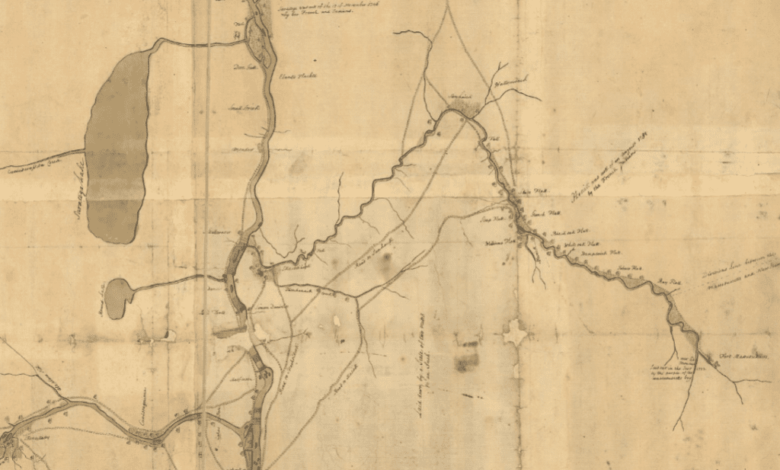
Illustrations, from above: “Map of the northern parts of New York,” ca. 1758 showing the Hudson, Mohawk, and Hoosic River route to Fort Massachusetts along with Saratoga Lake (Norman B Leventhal Map and Education Center), a larger version is available here; Detail of an 1807 drawing of a Durham boat with sails, the kind used before the canals were built, traveling on the Mohawk River; Detail of a map showing Stillwater and Schaghticoke where the Hoosic River enters the Hudson River from “A colored map of the route between Albany and Oswego drawn about 1756 on a scale of 2 miles to an inch,” (Leventhal Map & Education Center), a larger version online here; Map showing Old Champlain Lock 15, the Drydock, the Fort Edward Feeder Canal and the waste weir; and 1856 Map of Waterford Village showing Champlain Canal Sidecut.
This essay is drawn from The Northern Inland Passage: An Interpretive Guide to the Champlain Canal Region published by Lakes to Locks Passage in 2019 and funded in part by a grant from the National Scenic Byways Program and from the Alfred Z. Solomon Charitable Trust. It has been only slightly edited and reformatted.
Source link