As unusually warm and dry fall weather pushes the Fire Danger to HIGH across the entire state, new real-time weather data tool to help inform New Yorkers when there is an increased risk of wildfires has been announced. The new system’s most recent map shows much of the State’s Fire Danger Rating is now VERY HIGH and EXTREME.
New York State Department of Environmental Conservation and New York State Mesonet at the University at Albany researchers are utilizing data from the University at Albany’s statewide weather network to generate daily Fire Danger Ratings to offer more reliable wildfire information and improve public safety.
“We’re seeing the effects of climate change in real time, with dangerous wildfire seasons across the continent year after year,” Governor Kathy Hochul said in announcing the new partnership on Friday.
The current HIGH fire danger means all fine, dead fuels ignite readily and fires start easily from most causes, including unattended brush and campfires. Fires may become serious and difficult to control.
The New York State Mesonet is the nation’s most advanced and largest early-warning weather detection system. It features 127 standard weather observation stations that cover the entire state, including at least one in every county and borough.
Each site measures temperature, humidity, wind speed and direction, pressure, precipitation, solar radiation, snow depth, soil information and offers camera images. The data is collected in real-time every five minutes, feeding weather prediction models and decision-support tools for users across New York.
 DEC’s Wildfire Predictive Services issues and updates a fire danger map that divides New York into multiple Fire Danger Rating Areas and then rates each on a wildfire risk scale from LOW to EXTREME.
The enhanced data collection helps identify the local variability of fire danger across the state, allowing community leaders, emergency managers and everyday New Yorkers to adapt their activities to prevent fires and reduce damage.
It will be publicly available, offering year-round fire danger ratings (something DEC has never done) and, in conjunction with DEC’s weather forecasts, other fire weather environmental and meteorological variables for all Fire Danger Rating Areas in New York.
Similar to the current National Interagency Fire Center’s Remote Automatic Weather Stations (RAWS) system, the New York State Mesonet will provide the national Weather Information Management System, which serves as the host for the National Fire Danger Rating System, with the data necessary to publish regional fire danger rating products.
The public website available through the New York State Mesonet offers current and historic fire weather information, updated daily. The project is funded by DEC through a U.S. Department of Agriculture Forest Service Wildfire Risk Reduction Grant.
View the New York State Mesonet Fire Danger Products page here.
The DEC Fire Danger Map will continue to host the fire danger map in addition to specific information about fire danger ratings and the fire danger rating areas.
Open burning is prohibited in New York, with these exceptions:
- Campfires or any other outdoor fires less than three feet in height and four feet in length, width or diameter are allowed.
- Small cooking fires are allowed.
- Ceremonial or celebratory bonfires are allowed. Disposal of flags or religious items in a small-sized fire is allowed, if it is not otherwise prohibited by law or regulation.
- Only charcoal or dry, clean, untreated or unpainted wood can be burned.
- Fires cannot be left unattended and must be fully extinguished.
For more information about fire safety and prevention, go to DEC’s FIREWISE New York webpage.
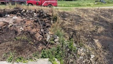
Illustrations, from above: NYS Mesonet Fire Weather on Saturday, October 26th; A fire at Spruce Lake in Hamilton County on October 9th.

Source link